Nondestructive Testing Van
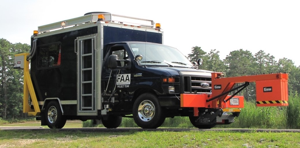
NDT Van with 2D/3D Imaging (rear), Inertial Profiler (side), and GPR (front) Equipment (Click to Zoom)
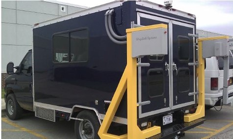
NDT Van with 2D/3D Imaging (rear) Equipment (Click to Zoom)
The Nondestructive Testing Van, or NDT Van, is a mobile platform that carries multiple sets of testing equipment to record numerous pavement characteristics. The van, a 2010 Ford E350, was purchased and received a rear box and equipment setup in 2010 and 2011. The NDT Van contains three main data recording systems: 2D/3D imaging, ground penetrating radar (GPR), and an inertial profiler. The pavement imaging uses lasers to record the surface conditions, and can determine pavement distresses. The GPR devices use electromagnetic signals that penetrate into the pavement to investigate the subsurface condition in a nondestructive manner. The inertial profiler is a multi-sensor system that records a pavement surface profile, which can be analyzed to determine surface roughness indexes and surface elevation. The main strength of the NDT Van lies in its ability to host all of these data acquisition systems on a single platform while maintaining mobility. In addition, it is capable of recording accurately at high speeds, reducing the time required to perform testing. The NDT Van is intended to be a “one-stop-shop” for the airport pavement branch’s testing needs. Since its introduction, the van has been used on many FAA construction cycle tests and on airports across the US.
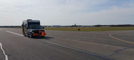
NDT Van Performing Testing at Cape May County Airport (Click to Zoom)
The NDT Van’s imaging system consists of a laser imaging camera mounted to the rear of the vehicle as well as a forward-facing right-of-way camcorder. To collect data, the van is driven down the runway in parallel, slightly overlapping runs, recording strips of pavement. Once complete, a software is used for analysis. The images are stitched together to form a complete 3D surface, then analysis is performed, which includes the calculation of Pavement Condition Index (PCI), pavement texture, and grooving measurements. More information can be found on the 2D/3D imaging webpage.
The GPR antennas on the front of the NDT Van allow investigation up to 15 feet below the pavement surface for layer thickness, rebar placement, and other buried infrastructure. Their frequency characteristics ensure the observation of thick pavement structures while keeping data quality as high as possible. Testing is performed by driving the van over the area of interest, and analysis is done using imaging software. See the GPR webpage for more details.
The inertial profiler uses three devices mounted to a bracket on the side of the NDT Van:
- a vertical accelerometer, which measures vertical bouncing of the vehicle
- a distance measuring instrument, which measures horizontal travel of the vehicle
- a laser sensor, which records the vertical distance between the sensor and the pavement surface
Combining the data streams gives the pavement surface profile. Analysis is done using software, such as ProFAA for calculation of roughness indexes, or ProGroove for examination of groove spacing and size. Further detail can be found on the inertial profiler webpage.
For more information on the devices and software mentioned on this page, follow the links to the detailed FAA webpages.
2D/3D Imaging
GPR
Inertial Profiler
ProFAA
ProGroove
Return to Showcase Research Projects Overview